Geotechnical exploration in Los Angeles is the critical first phase of any construction or infrastructure project, encompassing the systematic investigation of subsurface conditions to inform safe, cost-effective design. The region's complex geology, shaped by tectonic forces and sedimentary processes, demands a thorough understanding of soil, rock, and groundwater behavior before a single foundation is poured. Exploration services range from preliminary site reconnaissance and geophysical surveys to detailed drilling, sampling, and in-situ testing programs. For projects spanning the Los Angeles Basin, Santa Monica Mountains, or San Fernando Valley, these investigations identify potential hazards such as liquefiable soils, expansive clays, bedrock irregularities, and active fault traces that could compromise structural integrity. A robust exploration program not only satisfies regulatory requirements but also mitigates risk, reduces unforeseen construction costs, and protects long-term investments in one of America's most seismically active metropolitan areas.
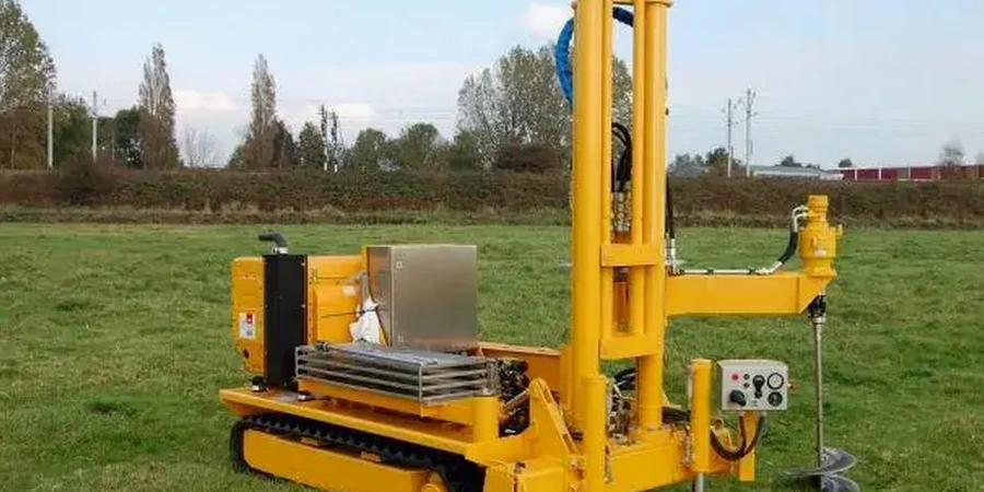
Los Angeles sits atop a dynamic geological mosaic where the Pacific and North American plates grind past each other along the San Andreas Fault system, while numerous blind thrust faults—like the Puente Hills Fault—underlie densely populated areas. The basin is filled with thousands of feet of alluvial sediments, marine deposits, and young Holocene soils that exhibit highly variable engineering properties. Near the coast, loose beach sands and artificial fill pose significant liquefaction and settlement risks, while hillside terrains present challenges from weathered bedrock, ancient landslides, and colluvial soils. Groundwater can be encountered at shallow depths in the LA Basin, complicating excavations and requiring dewatering. The Cone Penetration Test (CPT) is particularly valuable here, as it provides continuous, real-time data on soil stratification, pore pressure, and liquefaction susceptibility without the disturbance associated with traditional drilling. Understanding these local conditions is essential for tailoring exploration methods to each unique site.
Regulatory compliance for geotechnical exploration in Los Angeles is governed by a layered framework of state and local codes. The California Building Code (CBC), based on the International Building Code, mandates site-specific geotechnical investigations for nearly all structures, with particular emphasis on seismic design parameters per ASCE 7 and Chapter 16. The City of Los Angeles Department of Building and Safety (LADBS) enforces additional requirements through its Site-Specific Seismic Hazard Analysis guidelines, especially within designated Fault Rupture Study Zones, Liquefaction Hazard Zones, and Earthquake-Induced Landslide Zones mapped by the California Geological Survey. Exploration reports must address grading regulations in the LAMC Chapter 70, including soil bearing capacity, slope stability, and expansive soil mitigation. For hillside construction, the Hillside Ordinance imposes stricter investigation protocols. These regulations ensure that exploration data directly informs foundation design, retaining structures, and grading plans in a city where geological hazards are omnipresent.
The types of projects requiring comprehensive geotechnical exploration in Los Angeles are diverse and ever-present. High-rise developments in Downtown LA and Century City demand deep borings and advanced testing to design deep foundations like drilled piers or piles that extend through soft alluvium into competent bedrock. Transportation infrastructure projects, including Metro rail expansions and freeway widenings, rely on extensive subsurface characterization to assess ground behavior under dynamic loading. Residential subdivisions in hillside areas require detailed slope stability analyses and bedrock mapping. Even smaller-scale developments, such as retaining walls, swimming pools, or ADU construction, trigger the need for investigation per LADBS guidelines. The CPT has become a preferred tool for many urban sites due to its minimal footprint, rapid deployment, and ability to generate high-resolution data for liquefaction assessment—critical in a region where much of the basin is mapped as a potential liquefaction zone. Similarly, environmental site assessments often integrate exploration techniques to characterize soil and groundwater contamination at brownfield redevelopment sites across the city.
¿Necesita una evaluación geotécnica?
Respuesta en menos de 24h.
La forma más rápida de cotizar
Email: contato@sondajespt.com
Available services
Frequently asked questions
What is the purpose of a geotechnical exploration program?
A geotechnical exploration program systematically investigates subsurface soil, rock, and groundwater conditions to evaluate their impact on proposed construction. It identifies potential hazards like liquefaction, expansive soils, or landslides, provides parameters for foundation design, and ensures compliance with local building codes. The data gathered directly influences structural safety, construction methods, and long-term performance of the project.
When is a geotechnical investigation required in Los Angeles?
The California Building Code and LADBS require a geotechnical investigation for most new construction, additions, and grading projects. It is mandatory in mapped seismic hazard zones, hillside areas, and for structures exceeding specific size or occupancy thresholds. Even projects like retaining walls over four feet, swimming pools, or ADUs trigger the need for subsurface evaluation to address safety and code compliance.
How deep do geotechnical borings need to go for a typical Los Angeles project?
Boring depth depends on the structure type, subsurface conditions, and local regulations. In Los Angeles, borings for shallow foundations typically extend to at least 1.5 times the foundation width below grade or until competent bearing strata is encountered. For deep foundations, borings often reach 20 to 60 feet or deeper to penetrate liquefiable layers, with some high-rise investigations extending over 100 feet to characterize bedrock.
What is the difference between a standard geotechnical boring and a CPT test?
Standard borings involve drilling, extracting soil samples, and performing Standard Penetration Tests at intervals, providing discrete data points. A Cone Penetration Test (CPT) pushes an instrumented cone into the ground continuously, recording tip resistance, sleeve friction, and pore pressure in real time. CPT offers high-resolution, nearly continuous profiles without disturbing the soil, making it superior for liquefaction assessment and stratigraphic detailing, though it does not recover physical samples.